

September 23, 2025
A Massive Public Works Project in Toronto Creates a Park and Revives Ecologies
Toronto’s waterfront along Lake Ontario is notoriously fragmented, making awkward next-door neighbors of parks, beaches, event centers, an erstwhile amusement park, condo towers jutting up at the lakefront’s sharp edge, and pockets of industrial land in various stages of disuse, all cut off from the rest of the sprawling metropolis by the Gardiner Expressway.
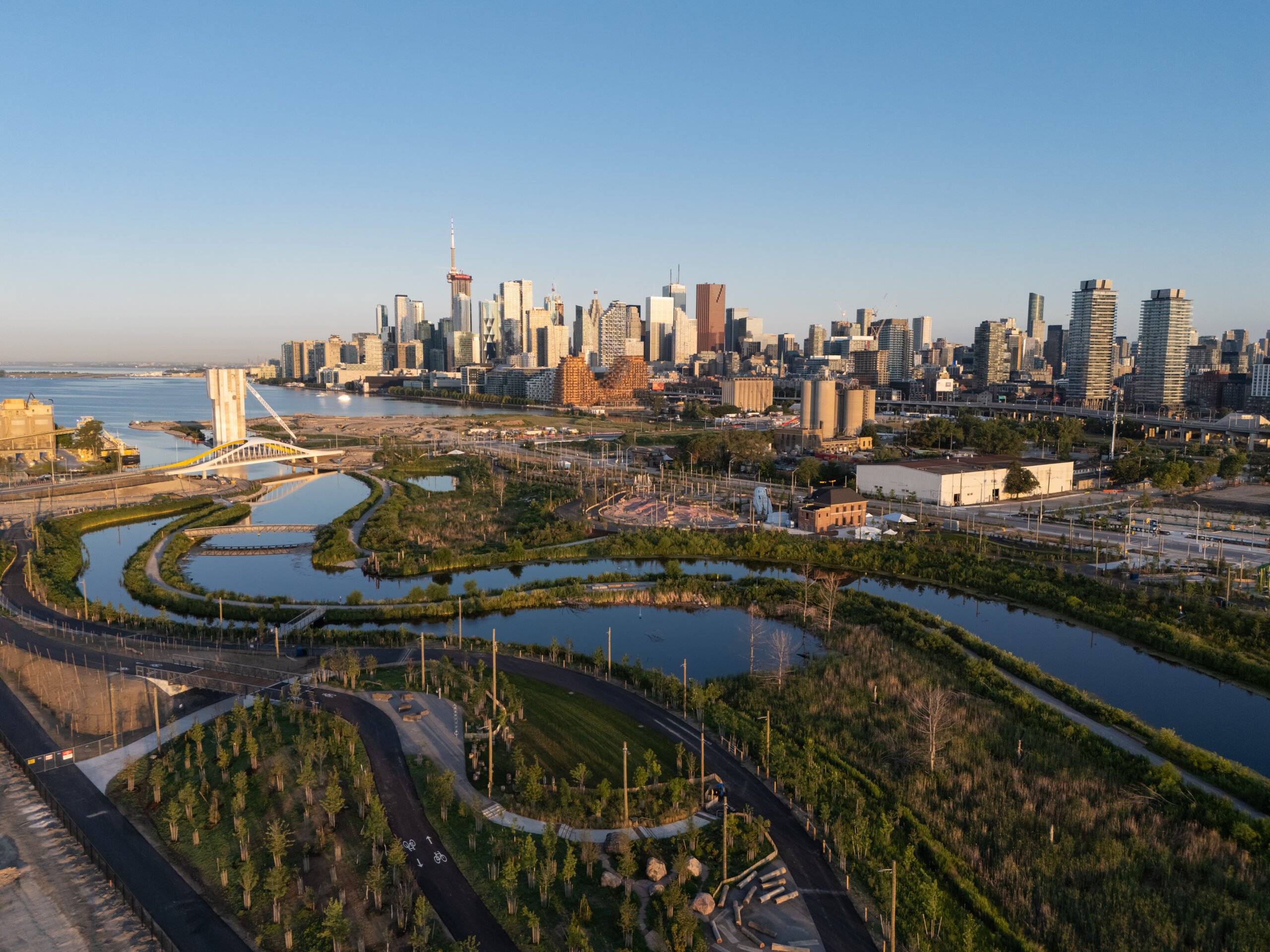
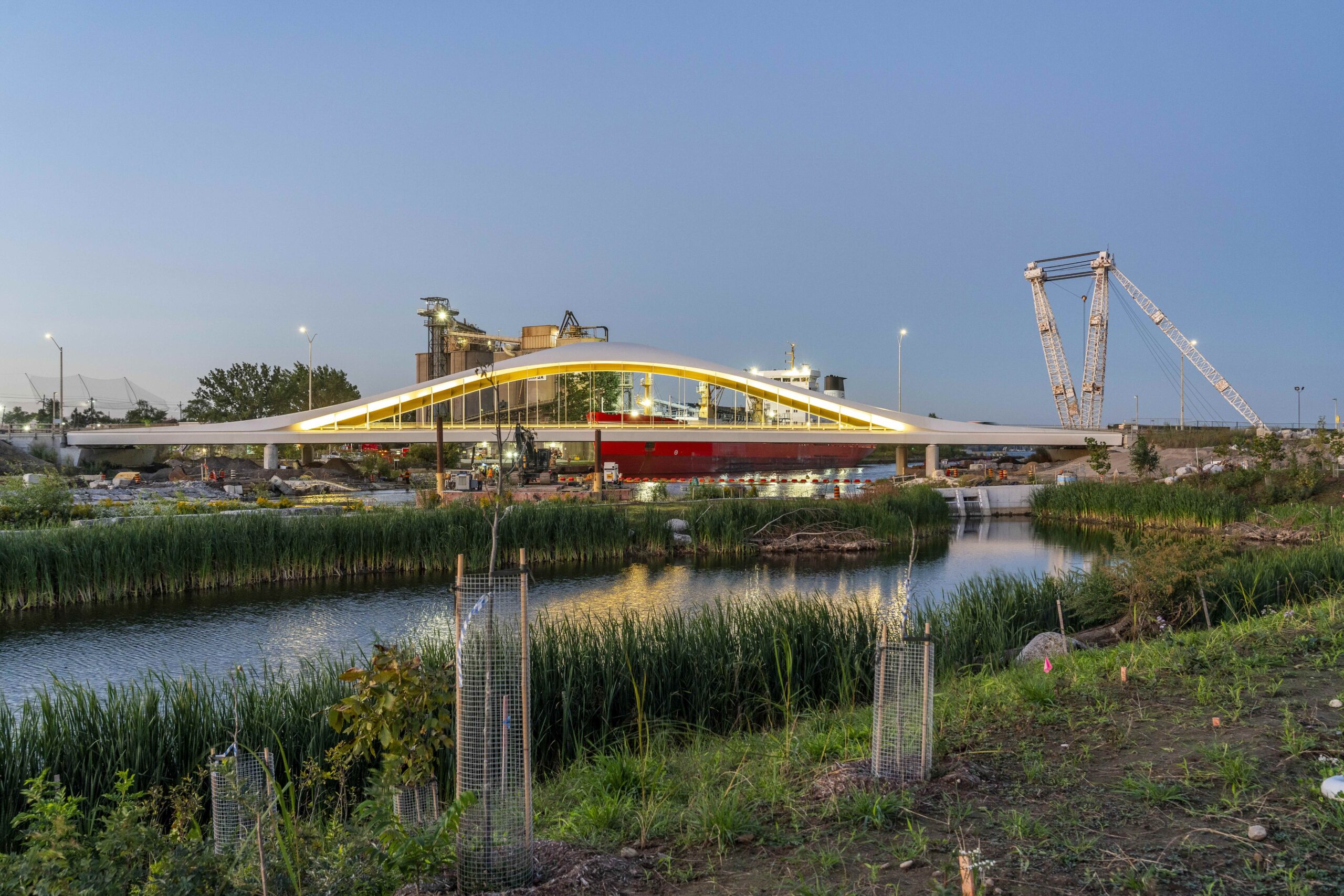
The multi-decade, multi-purpose Port Lands Flood Protection project intervenes at one of the waterfront’s largest industrial white elephants, where over a century of outmoded urban planning generated a litany of environmental and other challenges. Led by landscape firm MVVA – which won an invited competition by Waterfront Toronto in 2007 to “renaturalize” and remediate the Port Lands and prepare it for future development – the ecological-infrastructural project celebrated its first public-facing milestone this summer, with the opening of Biidaasige Park. The new park, whose name means “light shining toward us” in the Ojibwa language, is just the tip of the Port Lands effort, a more than $1 billion, generational feat in ecological engineering and planning.
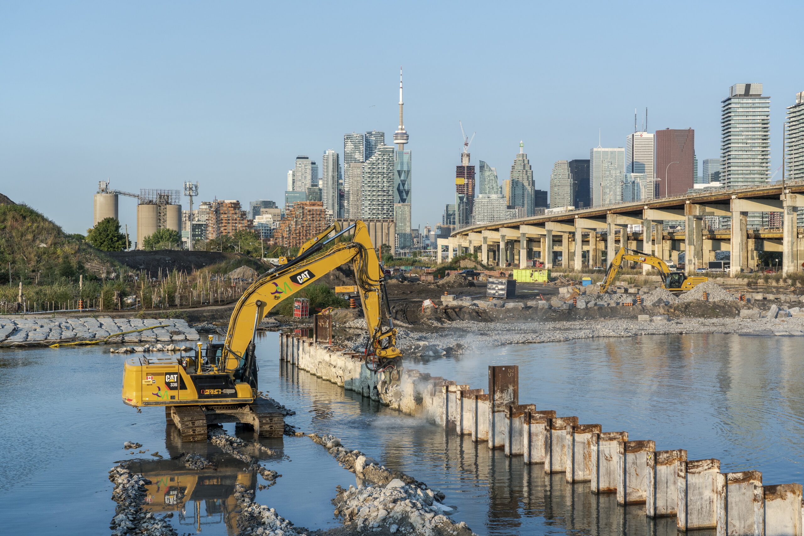
The mouth of the Don River, which flows southerly through Toronto and spills out into the lake, had historically been a marshy, diffuse delta, comprising wetlands that could convey and purify the Don’s typically staid flow and occasionally hurricane-level output. But intensive industrial uses along the lower Don throughout the 1800s prompted the city to channelize parts of the river, drain and fill in much of the marshland, and, in 1912, divert its mouth in a sharp, 90-degree turn westward. Those moves – which resulted in the creation of the new industrial zone – exacerbated toxic buildup and environmental contamination in the Port Lands, and increased flooding potential both in the Port Lands and upstream, for the next century.
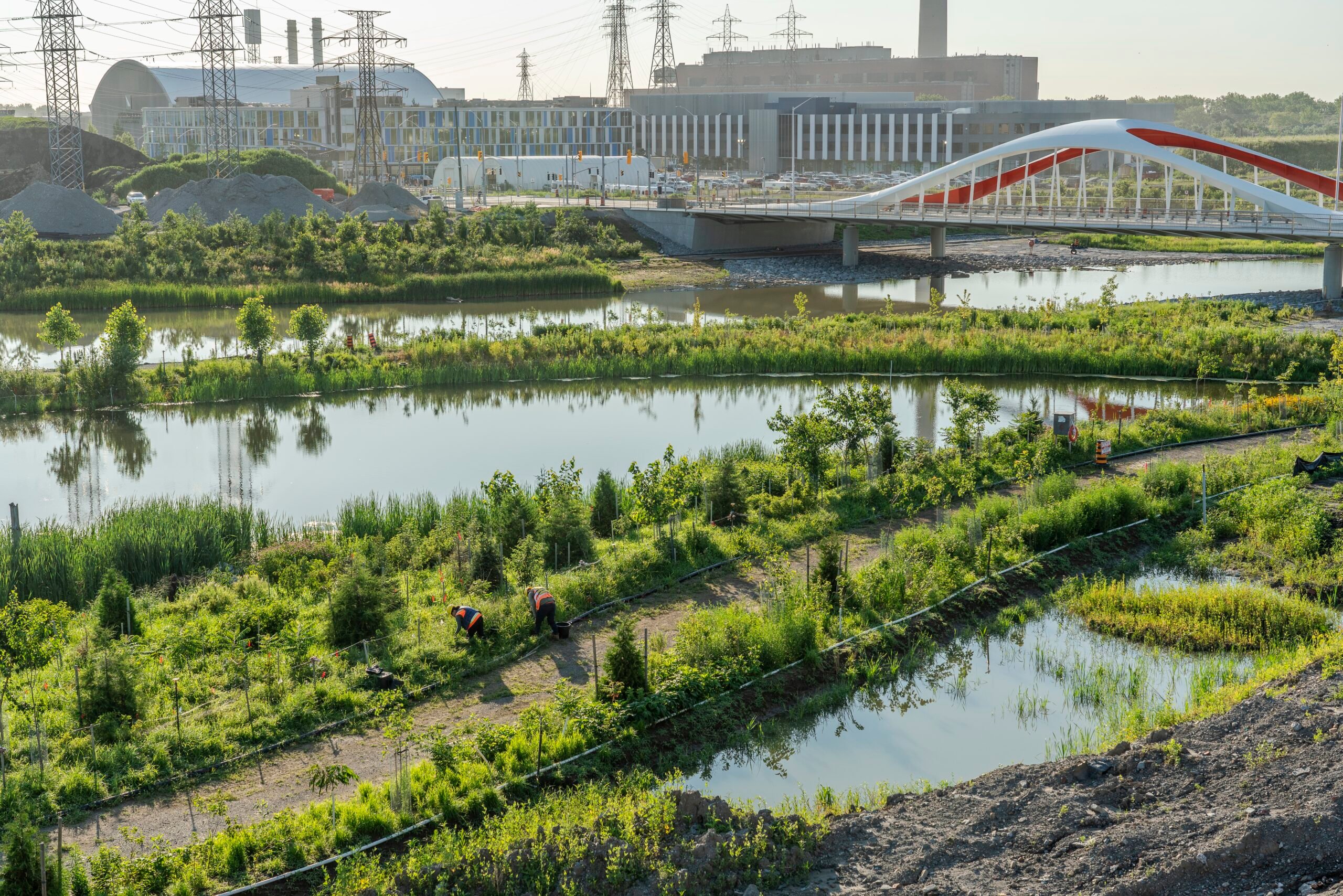
“A generation ago, people saw there was a problem here … and that the hard engineering infrastructure that created these conditions wasn’t working,” says Emily Mueller De Celis, a partner at MVVA, nodding to community groups such as Bring Back the Don in the early 1990s. “There was an acknowledgement that green infrastructure could re-heal the Don and bring it back to life.” MVVA’s winning framework plan for the Port Lands included a “re-naturalized” river mouth to alleviate flood risk, a massive effort to decontaminate and move over a million cubic meters of soil, and the creation of a new landscape for wildlife – and later, people – to take root.


That landscape for wildlife extends below the water’s surface too, explains Herb Sweeney, a principal at the firm: “One of the most spectacular aspects of this project is not visible to the public.” He describes an aquatic timber-and-rock “fabric” that plays host to both moisture-loving willow trees that strengthen the river banks and “fish hotels” that help recreate the riverine and lacustrine habitat. Above ground, Sweeney says he’s seen red-tailed hawks and bald eagles return to the area, even before the landscaping was complete.
The new mouth of the river is “re-engaged to where it would have been,” Sweeney adds. The engineering team excavated a deeper river valley and retained soil on site, allowing the river plain to be inundated, if need be, and mimicking the river delta’s original ecology to aid in flood protection. The move also allowed for the creation of the new 100-acre island called Ookwemin Minising (“place of the black cherry trees”) that contains 50 acres of public park space, including Biidaasige, and thousands of planned homes. This interweaving of various complex ecological, infrastructural, and development goals is what sets this waterfront rehabilitation project apart – in character and scale – from many others in North American cities.
As for the project’s social and place keeping objectives, Mueller de Celis says, the newly opened Biidaasige offers “a totally different kind of experience… The rest of the waterfront is along dock walls, a hard edge, and this is a huge expanse of naturalized water’s edge, where people can go down and kayak, canoe, fish in.” And with the land remediated, upstream neighborhoods fortified against flooding, and the Port Lands ecology on a path toward restoration, the city can proceed with its mixed-use vision, a strategy Mueller de Celis calls “landscape-led: Parks before all the neighborhoods.”
Would you like to comment on this article? Send your thoughts to: [email protected]
Latest
Products
Feria Hábitat València 2025 Exhibits the Best of Spanish Craft and Sustainable Design
Despite a delayed opening due to weather, the Valencian community’s annual furniture show returned with record numbers.
Viewpoints
Bas Smets on Designing Augmented Landscapes
The landscape architect discusses his design for Notre-Dame, this year’s Venice Architecture Biennial, and what he means by biospheric urbanism.